Back when the New Year turned 2000, some sort of promised computronic glitch was supposed to send us back to 1900. Remember that? I booted up everything I could find, sat in a room full of Coleco Adams, VIC 20s and TI 99/4s, wearing a high starched collar and waiting for President McKinley to send wire that all was well. It never happened.

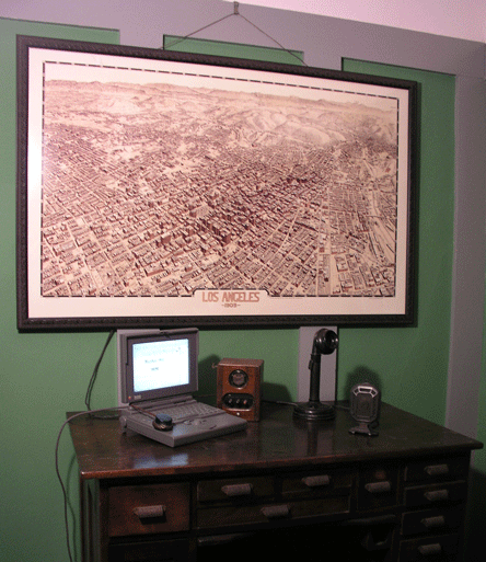
I won‘t say that I go through the same ritual every year, but it was hard not to plummet, turning as we were to 2009, deep into the wonder of 1909. You may lose yourself in the limpid pools of your lover‘s eyes, or the majesty of your maker‘s sunsets; I was transported to the world of Los Angeles, 1909, courtesy the Western Lithograph Company. Unfortunately, I came back. So I‘ll plop down in front of my beloved Apple Lisa, which once failed to transport me to 1900, and try and take you around a bit to Bunker Hill, 1909.
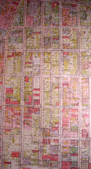
Our journey involves a map. There are in fact two versions of the beast-in-question: one published by the Birdseye View Publishing Company, which included a legend at the bottom. Another variation without the legend, commonly known as the "Worthington Gates," as it names its compiler, was published the same year by Birdseye (or "Birds Eye" as they’re called on the WG; it as well identifies itself as product of the Western Litho. Co.). For the record, contrary to popular belief, these are not entirely the same map. For example, here‘s the corner of Fourth and Hill. The Birdseye-View map:
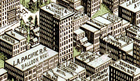
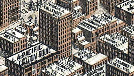
Now note the Worthington Gates–which we should note was also printed smaller, and in and of an overall brownish hue, as opposed to the verdant greens of Los Angeles in the Birdseye above–apparently published later: while the buildings have remained untouched, their naming has altered slightly (the LAP building) and some names have been added (note Danziger and University Club to the north of the Wright-Callender).
Very well. We commence our journey through the interstices of space-time!
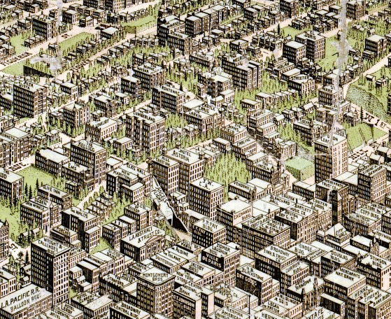
From the get-go, let’s get a feeling for just how high the Hill once lorded over downtown:
Starting with our western edge:
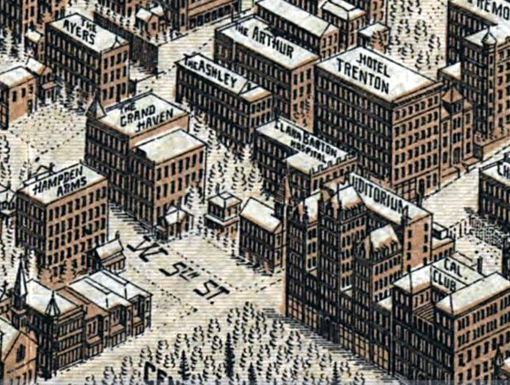
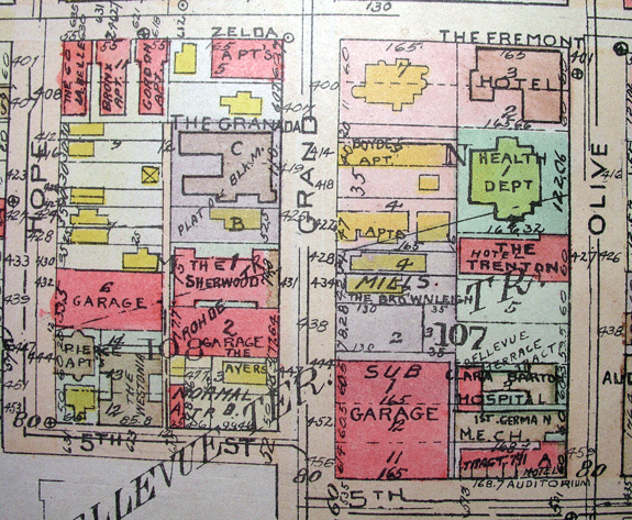
Fifth and Olive, of course, the unassuming future site of the Auditorium Hotel, a mere year away. In the future. Heading up Olive into the Hill there’s our old friend the Trenton.
Swinging around to our southern border:
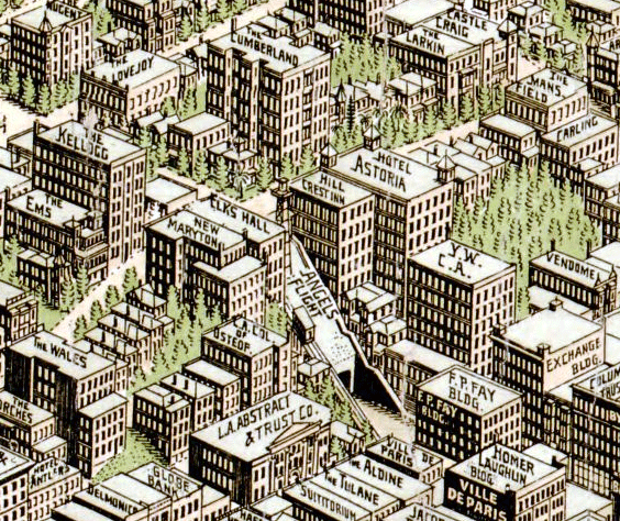
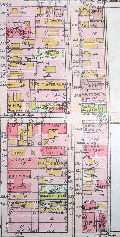
Third and Grand at upper left, Third and Olive center, Third and Hill bottom right. The Nugent stands proud at 3&G; there’s the Elks, the Astoria, the YWCA and of course perennial favorite Angels Flight. Note that what’s usually known as the Mission Apartments over at Second and Olive is called the Castle Craig.
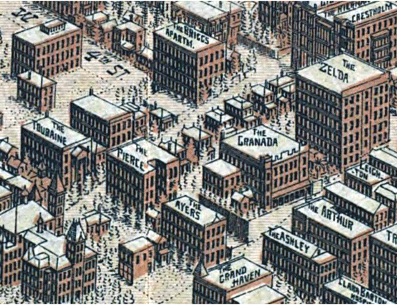
A couple more you should recognize above–Zelda at Fourth and Grand, over her shoulder, the Touraine.
Of course no account of BH would be complete without an image of the Second/Hill area:
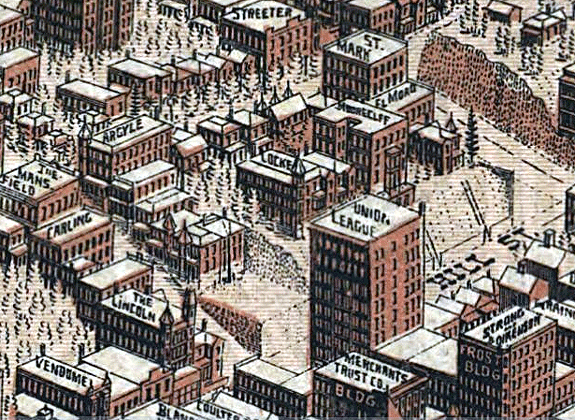
…covered of course to an absurd degree here and here. In this depiction one gets a feeling for the majesty of the Hotel Locke, and of the ornate nature of those façades lopped off due to Second Street‘s widening during construction of the tunnel (say goodbye to the Argyle turret!).
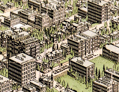
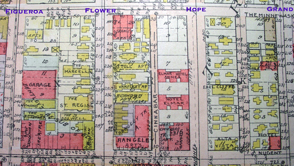
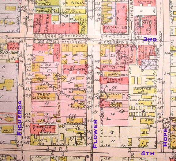
The Rose Mansion at the bottom corner of Fourth and Grand (closest to the Fr in Fremont). Kitty-corner across from the Rose are the towers of the Hershey/Castle; next to her, the magnificent Brunson Mansion. The Fleur de Lis you’ll remember as the blink-of-an-eye Bryan Mansion. Upper right, looming large at Third and Bunker Hill Avenue is the Alta Vista; behind, on Flower, the St. Regis.
While we’re on the subject of Buker Hill Ave., let’s take a closer look-see:
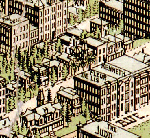
…heading up the street we’ve got the Salt Box, 333 South Bunker Hill, the Castle, the Lady McDonald, and the distinctive tower of the Foss/Heindel all on the east side of the street.
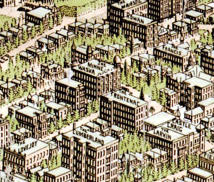
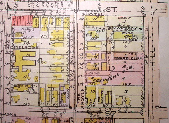
A bit further north is Hill standout The Dome (aka the Minnewaska) at Second and Grand; the Majestic, top, at First and Hope, later became the Rossmere; our turreted pal in the upper left is at First and Flower.
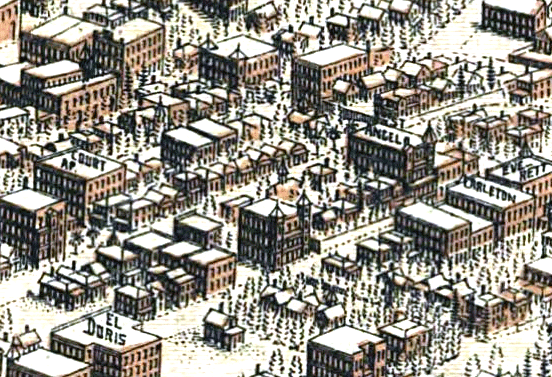
Bunker Hill north of First tends to get the short shrift around here. (For that we apologize and look forward to remedying this injustice in the coming year.) Not that we haven‘t poked around up there a bit:
Here for example, center right, is the St. Angelo, up on North Grand. Lurking behind would be the Larronde residence.
And that’s just a taste of the Hill. (Where, you ask, are the Melrose and Fremont, to name but two?) And the map stretches from West Lake Park to the river. But don’t take my word for it. Whether you cleave to the Worthington Gates, or cotton to the Birdseye View, there’s no better way to spend the better part of, oh, the rest of your life than poring over these maps. You’ll find as well that a quick internet search will reveal no lack of suitable-for-framing reproductions to be had of both kinds.
Now then. Having applied quantum gravity to traversable wormhole metrics, and stuff, I’m pretty sure I’ve constructed a time machine by affixing a Powerbook 180 to the Worthington Gates.
See you in the lobby of the Cumberland, Kip Thorne!